Micro Station

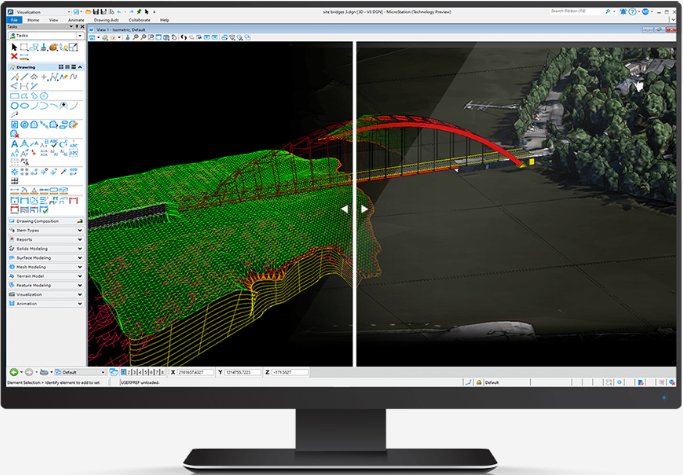
MicroStation
CAD leader for precise 2D and 3D infrastructure designs
MicroStation is the computer-aided design (CAD) software that users worldwide trust for creating precise 2D and 3D drawings for infrastructure projects. Engineers, architects, and construction professionals openly collaborate to deliver inspiring projects, utilizing the industry leading DGN file format. MicroStation can help you deliver your designs on time and on budget, even as project complexities and scale increase. With extensive interoperability and collaboration capabilities, and the flexibility to work with 2D or 3D in your BIM workflows, MicroStation gives you the confidence to know that your design intent will be clearly understood.
Work with Huge Data Sets
The CAD software that can handle the scale of data demanded by infrastructure projects. Use MicroStation to generate efficient 2D and 3D drawings for any size data set.
Utilize Truly Timeless DGNs
MicroStation is easy to use and master through a configurable environment with in-app learning, video tutorials, and extensive support that allows you to become an expert in no time.
ContextCapture
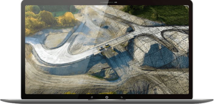
Precise Digital Twin of the Physical World
With ContextCapture, you can quickly produce even the most challenging 3D models of existing conditions for infrastructure projects of all types, derived from simple photographs and/or point clouds.
ContextCapture Cloud Processing Services
Create a Digital Twin Anytime, Anywhere on Any Device. Offload the processing of reality modeling data from desktop and mobile devices to the cloud to speed the creation of 4D digital context.
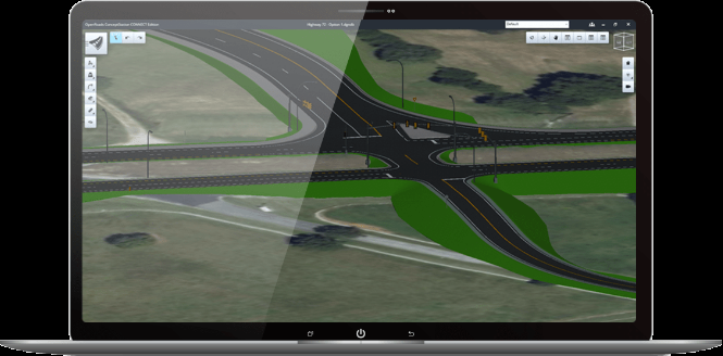
OpenRoads
Detailed Concepts and Budgets in Hours
OpenRoads ConceptStation produces multiple concepts in hours and enables edits on the fly during stakeholder meetings.
No Detail Left Behind
Reduce complexity and accelerate workflows with plan and construction documentation, surveying, stormwater design and analysis, visualization, geotechnical, underground utilities, and detailed roadway design—all in one application.
GEOPAK

Advanced Designing Model
Bentley’s Power GEOPAK provides information-rich modeling integrated with CAD, mapping, GIS, and business tools such as PDFs, i-models, and hypermodels. GEOPAK is used for roads and highways, railways, and public works projects as well as commercial, industrial, and environmental land development.
Flexible and configurable
GEOPAK enables users to create intelligent models containing not only terrain data but also roadway or site features. Features are visually distinguished by structure, appearance, and symbology.
Other Bentley brands
Descartes | MAP | MX | OpenRoads | ORBIT | Pointools