LiDAR
TerraGeo has a team of highly qualified Remote Sensing LiDAR professionals with experiences in different domains. The group has developed several processes and algorithm to automate the process of LiDAR data classification and analysis. Various tools have been developed to undertake stringent quality checks to provide world-class quality data.
Our experienced team provide industry standard LiDAR based products. We have all the necessary skills to analyse and process all types of LiDAR data. TerraGeo provide different services on LiDAR as follows:
Areial LiDAR
- Powerline
- Bare-earth classification
- Forest Mapping
- Detailed Classification
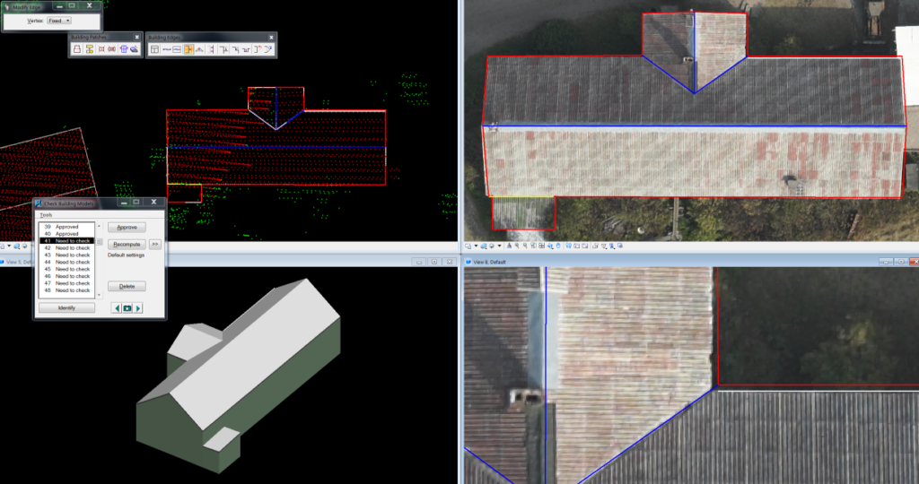
- 3D modelling and Volumetric analysis
Terrestial LiDAR
- Terrestrial Mobile LiDAR / Moblie Mapping
- Terrestrial Static LiDAR
Others
- Ground and non-ground Classification.
- Advanced classification Building, Road, Vegetation etc.
- Ortho generation &contour generation using DEM.
- Feature Extraction.
- 3d Building modelling.